
Salford topographic map
Interactive map
Click on the map to display elevation.
About this map
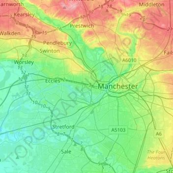
Name: Salford topographic map, elevation, terrain.
Location: Salford, Greater Manchester, England, United Kingdom (53.41589 -2.48973 53.54214 -2.24511)
Average elevation: 52 m
Minimum elevation: 11 m
Maximum elevation: 137 m