
Oldenburg topographic map
Interactive map
Click on the map to display elevation.
About this map
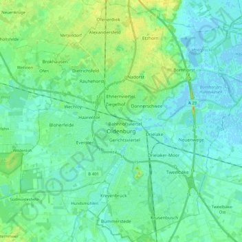
Name: Oldenburg topographic map, elevation, terrain.
Location: Oldenburg, Lower Saxony, Germany (53.08312 8.12952 53.20476 8.31221)
Average elevation: 7 m
Minimum elevation: -3 m
Maximum elevation: 27 m
Other topographic maps
Click on a map to view its topography, its elevation and its terrain.
Oldenburg
Germany > Lower Saxony > Oldenburg
Oldenburg, Lower Saxony, 26122, Germany
Average elevation: 10 m