Geolocate

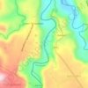
Sanggaya topographic map

Click on the map to display elevation.

About this map

Name: Sanggaya topographic map, elevation, terrain.

Location: Sanggaya, Talakag, Bukidnon, Northern Mindanao, 8708, Philippines (8.03781 124.76135 8.07781 124.80135)

Average elevation: 1,356 m

Minimum elevation: 1,089 m

Maximum elevation: 1,605 m

Other topographic maps

Click on a map to view its topography, its elevation and its terrain.
Gear up for your next adventure:

🧴SPF 50+ Bulk Sunscreen - Maximum protection for long-term outdoor exposure
🚴Cycling Backpacks - Backpacks for cyclists
🩹Wilderness First Aid Kits - Comprehensive medical kits tailored for hiking and remote exploration
🧴Sunscreen SPF - Sun protection for outdoor activities
🪢550 Survival Paracord - Versatile cordage for gear repair and emergency lashing

As an Amazon Associate, this site earns from qualifying purchases at no extra cost to you.