Geolocate

Rothwell topographic map

Click on the map to display elevation.

About this map
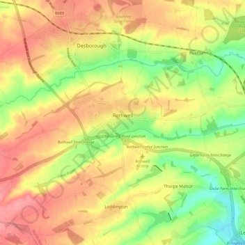
Name: Rothwell topographic map, elevation, terrain.

Location: Rothwell, North Northamptonshire, England, United Kingdom (52.40352 -0.84283 52.43758 -0.73461)

Average elevation: 117 m

Minimum elevation: 66 m

Maximum elevation: 159 m

Gear up for your next adventure:

🧥Packable Rain Jackets - Breathable waterproof layers for unpredictable mountain weather
🩹Blister Prevention Tape - Apply to friction points before they become painful sores
🦟Heavy Duty Insect Repellent - Essential protection against flies, mozzies, and march flies
🪑Portable Backpacking Chairs - A comfortable seat for studying maps at the end of the day
📍Handheld GPS - GPS devices for hiking and navigation

As an Amazon Associate, this site earns from qualifying purchases at no extra cost to you.