Geolocate

Hungerford topographic map

Click on the map to display elevation.

About this map
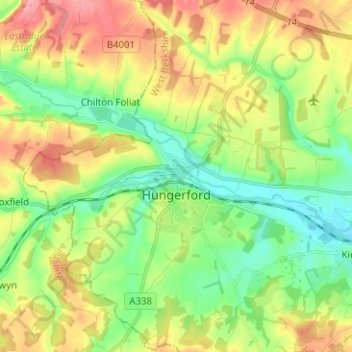
Name: Hungerford topographic map, elevation, terrain.

Location: Hungerford, West Berkshire, England, United Kingdom (51.37758 -1.57119 51.45585 -1.47284)

Average elevation: 131 m

Minimum elevation: 89 m

Maximum elevation: 191 m

Gear up for your next adventure:

📡Portable Emergency Radios - Stay informed about weather warnings and bushfire alerts
🎒Ultralight Backpacks - Lightweight packs for long hikes
🪢Paracord - Multi-purpose survival cord
🩹Wilderness First Aid Kits - Comprehensive medical kits tailored for hiking and remote exploration
📡Satellite Messengers - Emergency communication devices

As an Amazon Associate, this site earns from qualifying purchases at no extra cost to you.