
Thank you for supporting this site ❤️
Make a donation
Make a donation
Gear up for your next adventure:
As an Amazon Associate, this site earns from qualifying purchases at no extra cost to you.
Carcas topographic map
Click on the map to display elevation.
Thank you for supporting this site ❤️
Make a donation
Make a donation
Gear up for your next adventure:
As an Amazon Associate, this site earns from qualifying purchases at no extra cost to you.
About this map
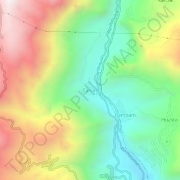
Name: Carcas topographic map, elevation, terrain.
Location: Carcas, Chiquián, Province of Bolognesi, Ancash, Peru (-10.13705 -77.18437 -10.09705 -77.14437)
Average elevation: 3,533 m
Minimum elevation: 2,999 m
Maximum elevation: 4,281 m
Thank you for supporting this site ❤️
Make a donation
Make a donation
Gear up for your next adventure:
As an Amazon Associate, this site earns from qualifying purchases at no extra cost to you.