Geolocate

Ketton topographic map

Click on the map to display elevation.

About this map

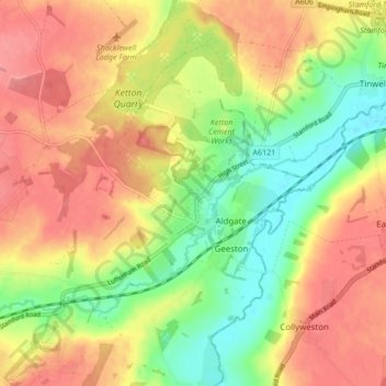
Name: Ketton topographic map, elevation, terrain.

Location: Ketton, Rutland, England, United Kingdom (52.60591 -0.57852 52.65729 -0.52074)

Average elevation: 68 m

Minimum elevation: 24 m

Maximum elevation: 104 m

Other topographic maps

Click on a map to view its topography, its elevation and its terrain.

Exton

United Kingdom > England > Rutland

Average elevation: 113 m

Gear up for your next adventure:

🦯Adjustable Trekking Poles - Reduce impact on knees when descending steep topographic ridges
🧦Hiking Socks - Comfortable socks for long hikes
🆘Personal Locator Beacons (PLB) - Satellite emergency beacons for life-saving help in areas with no mobile coverage
🎧Bluetooth Outdoor Earbuds - Listen to navigation cues or podcasts during long solo treks
🔥Camping Stoves - Portable stoves for outdoor cooking

As an Amazon Associate, this site earns from qualifying purchases at no extra cost to you.