
Beyşehir topographic map
Interactive map
Click on the map to display elevation.
About this map
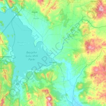
Name: Beyşehir topographic map, elevation, terrain.
Location: Beyşehir, Konya, Central Anatolia Region, 42700, Turkey (37.43107 31.27295 38.02017 31.98470)
Average elevation: 1,336 m
Minimum elevation: 1,101 m
Maximum elevation: 2,399 m