
Atlantic City topographic map
Interactive map
Click on the map to display elevation.
About this map
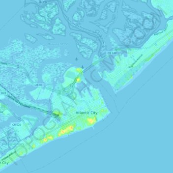
Name: Atlantic City topographic map, elevation, terrain.
Average elevation: 1 m
Minimum elevation: -5 m
Maximum elevation: 30 m
The city was incorporated in 1854, the same year train service began on the Camden and Atlantic Railroad. Built on the edge of the bay, this served as the direct link of this remote parcel of land with Philadelphia, Pennsylvania. That same year, construction of the Absecon Lighthouse, designed by George Meade of the Corps of Topographical Engineers, was approved, with work initiated the next year. By 1874, almost 500,000 passengers a year were coming to Atlantic City by rail. In Boardwalk Empire: The Birth, High Times, and Corruption of Atlantic City, "Atlantic City's Godfather" Nelson Johnson describes the inspiration of Jonathan Pitney (the "Father of Atlantic City") to develop Atlantic City as a health resort, his efforts to convince the municipal authorities that a railroad to the beach would be beneficial, his successful alliance with Samuel Richards (entrepreneur and member of the most influential family in southern New Jersey at the time) to achieve that goal, the actual building of the railroad, and the experience of the first 600 riders, who "were chosen carefully by Samuel Richards and Jonathan Pitney":