
Make a donation
Gear up for your next adventure:
As an Amazon Associate, this site earns from qualifying purchases at no extra cost to you.
Sutton topographic map
Click on the map to display elevation.
Make a donation
Gear up for your next adventure:
As an Amazon Associate, this site earns from qualifying purchases at no extra cost to you.
About this map
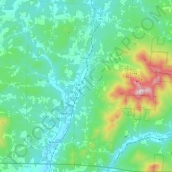
Name: Sutton topographic map, elevation, terrain.
Location: Sutton, Brome-Missisquoi, Estrie, Quebec, J0E 2K0, Canada (45.00777 -72.69482 45.16429 -72.47976)
Average elevation: 297 m
Minimum elevation: 131 m
Maximum elevation: 944 m
Make a donation
Gear up for your next adventure:
As an Amazon Associate, this site earns from qualifying purchases at no extra cost to you.
Other topographic maps
Click on a map to view its topography, its elevation and its terrain.
Paradis-des-Chênes
Canada > Quebec > Brome-Missisquoi > Dunham > Paradis-des-Chênes
Average elevation: 167 m
Make a donation
Gear up for your next adventure:
As an Amazon Associate, this site earns from qualifying purchases at no extra cost to you.