
Kings Langley topographic map
Interactive map
Click on the map to display elevation.
About this map
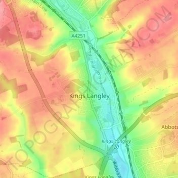
Name: Kings Langley topographic map, elevation, terrain.
Location: Kings Langley, Dacorum, Hertfordshire, England, United Kingdom (51.69534 -0.48507 51.73467 -0.44028)
Average elevation: 111 m
Minimum elevation: 63 m
Maximum elevation: 149 m
Other topographic maps
Click on a map to view its topography, its elevation and its terrain.
Dacorum
United Kingdom > England > Hertfordshire > Dacorum
Dacorum, Hertfordshire, East of England, England, United Kingdom
Average elevation: 142 m