
Peterculter topographic map
Interactive map
Click on the map to display elevation.
About this map
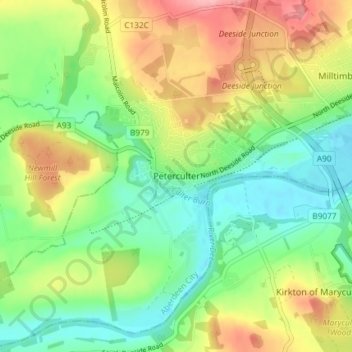
Name: Peterculter topographic map, elevation, terrain.
Location: Peterculter, Aberdeen City, Scotland, AB14 0SL, United Kingdom (57.07884 -2.28488 57.11884 -2.24488)
Average elevation: 64 m
Minimum elevation: 8 m
Maximum elevation: 147 m