Geolocate

Albury topographic map

Click on the map to display elevation.

About this map

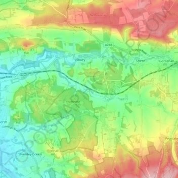
Name: Albury topographic map, elevation, terrain.

Location: Albury, Guildford, Surrey, England, United Kingdom (51.17743 -0.52236 51.24086 -0.46702)

Average elevation: 113 m

Minimum elevation: 37 m

Maximum elevation: 225 m

Gear up for your next adventure:

🎽Base Layers - Thermal base layers
🎧Bluetooth Outdoor Earbuds - Listen to navigation cues or podcasts during long solo treks
🔭Compact Hiking Binoculars - Lightweight optics for scouting routes or birdwatching
🔋Rechargeable Batteries - Eco-friendly power for high-drain GPS units and flashlights
📱Tablet Tripod Mounts - Steady platforms for viewing digital maps or taking long exposures

As an Amazon Associate, this site earns from qualifying purchases at no extra cost to you.