Geolocate

Serra do Rio do Rastro topographic map

Click on the map to display elevation.

About this map
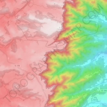
Name: Serra do Rio do Rastro topographic map, elevation, terrain.

Location: Serra do Rio do Rastro, Bom Jardim da Serra, Região Geográfica Imediata de Lages, Região Geográfica Intermediária de Lages, Santa Catarina, South Region, Brazil (-28.40096 -49.55883 -28.30606 -49.52335)

Average elevation: 996 m

Minimum elevation: 301 m

Maximum elevation: 1,569 m

Gear up for your next adventure:

🖼️Scratch-off Australia Map - Track the regions and peaks you have explored geographically
🧭Military Style Lensatic Compass - Durable sighting compasses for advanced land navigation and surveying
🎧Bluetooth Outdoor Earbuds - Listen to navigation cues or podcasts during long solo treks
🧤Hiking Gloves - Protective gloves for outdoor use
🧦Merino Wool Hiking Socks - Moisture-wicking socks to prevent blisters during long topographic surveys

As an Amazon Associate, this site earns from qualifying purchases at no extra cost to you.