Ōakura topographic map
Click on the map to display elevation.
About this map

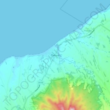
Name: Ōakura topographic map, elevation, terrain.
Location: Ōakura, New Plymouth District, Taranaki, 4314, New Zealand (-39.15753 173.91611 -39.07753 173.99611)
Average elevation: 74 m
Minimum elevation: 0 m
Maximum elevation: 605 m
Other topographic maps
Click on a map to view its topography, its elevation and its terrain.

New Plymouth
New Zealand > Taranaki > New Plymouth District
New Plymouth, New Plymouth District, Taranaki, 4310, New Zealand
Average elevation: 92 m

Waitara
New Zealand > Taranaki > New Plymouth District
Waitara, New Plymouth District, Taranaki, 4320, New Zealand
Average elevation: 28 m