Geolocate

Lelystad topographic map

Click on the map to display elevation.

About this map
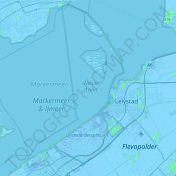
Name: Lelystad topographic map, elevation, terrain.

Location: Lelystad, Flevoland, Netherlands (52.38438 5.07459 52.69284 5.60587)

Average elevation: -1 m

Minimum elevation: -9 m

Maximum elevation: 10 m

Gear up for your next adventure:

🍳Camping Cookware - Cookware sets for outdoor meals
🪫Rechargeable Headlamps - USB rechargeable headlamps
🔥Windproof Plasma Lighters - USB rechargeable lighters that work in high-altitude winds
🧺Waterproof Dry Sacks - Organize your pack and keep electronics safe from rain and river crossings
🩹First Aid Kits - Emergency kits for hiking

As an Amazon Associate, this site earns from qualifying purchases at no extra cost to you.