Geolocate

Westbourne topographic map

Click on the map to display elevation.

About this map

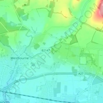
Name: Westbourne topographic map, elevation, terrain.

Location: Westbourne, Chichester, West Sussex, England, United Kingdom (50.85322 -0.93883 50.88009 -0.87685)

Average elevation: 26 m

Minimum elevation: 1 m

Maximum elevation: 111 m

Gear up for your next adventure:

🦘Outback Survival Gear - Essential gear for Australian outback
📻Handheld UHF Radios - Critical communication for groups in the Australian outback
🧤Hiking Gloves - Protective gloves for outdoor use
🩹Wilderness First Aid Kits - Comprehensive medical kits tailored for hiking and remote exploration
🦟Heavy Duty Insect Repellent - Essential protection against flies, mozzies, and march flies

As an Amazon Associate, this site earns from qualifying purchases at no extra cost to you.