

Aarhus topographic map
Click on the map to display elevation.
Aarhus
Western winds from the Atlantic and North Sea are dominant resulting in more precipitation in western Denmark. In addition, Jutland rises sufficiently in the centre to lift air to higher, colder altitudes contributing to increased precipitation in eastern Jutland. Combined, these factors make east and south Jutland comparatively wetter than other parts of the country. Average temperature over the year is 8.43 °C (47.17 °F) with February being the coldest month (0.1 °C or 32.2 °F) and August the warmest (15.9 °C or 60.6 °F). Temperatures in the sea can reach 17–22 °C (63–72 °F) in June to August, but it is not uncommon for beaches to register 25 °C (77 °F) locally.
About this map
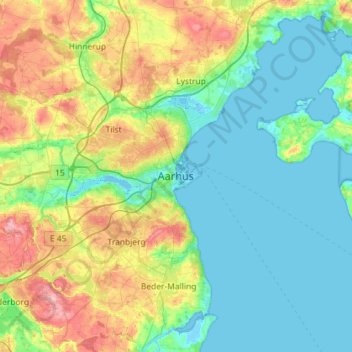
Name: Aarhus topographic map, elevation, terrain.
Average elevation: 35 m
Minimum elevation: -4 m
Maximum elevation: 133 m