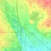
Campion topographic map
Click on the map to display elevation.
About this map

Name: Campion topographic map, elevation, terrain.
Location: Campion, Larimer County, Colorado, 86537, United States (40.33439 -105.11426 40.36321 -105.07433)
Average elevation: 1,558 m
Minimum elevation: 1,525 m
Maximum elevation: 1,583 m
Other topographic maps
Click on a map to view its topography, its elevation and its terrain.
Fort Collins
United States > Colorado > Larimer County
Fort Collins is situated at the base of the Rocky Mountain foothills of the northern Front Range, approximately 60 miles (97 km) north of Denver, Colorado, and 45 miles (72 km) south of Cheyenne, Wyoming. Elevation is 4,982 ft (1,519 m) above sea level. Geographic landmarks include Horsetooth Reservoir and…
Average elevation: 1,560 m
Estes Park
United States > Colorado > Larimer County
Estes Park sits at an elevation of 7,522 feet (2,293 m) on the front range of the Rocky Mountains at the eastern entrance of the Rocky Mountain National Park. Its north, south and east extremities border the Roosevelt National Forest. Lumpy Ridge lies immediately north of Estes Park.
Average elevation: 2,430 m