Geolocate

Seneca topographic map

Click on the map to display elevation.

About this map
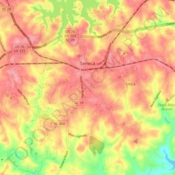
Name: Seneca topographic map, elevation, terrain.

Location: Seneca, Oconee County, South Carolina, United States (34.64130 -82.99495 34.71206 -82.92834)

Average elevation: 265 m

Minimum elevation: 200 m

Maximum elevation: 301 m

Gear up for your next adventure:

🎒Tactical Waist Packs - Quick access to your compass, phone, and snacks while walking
🧰Survival Kits - Essential survival gear
⌚Altimeter Barometer Watches - Outdoor watches with built-in sensors to track altitude changes and weather shifts
🦯Adjustable Trekking Poles - Reduce impact on knees when descending steep topographic ridges
🛰️Handheld GPS Units - Rugged GPS devices for tracking coordinates and elevation in the Australian bush

As an Amazon Associate, this site earns from qualifying purchases at no extra cost to you.