Geolocate

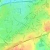
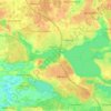
Silkeborg topographic map

Click on the map to display elevation.

About this map
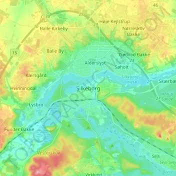
Name: Silkeborg topographic map, elevation, terrain.

Location: Silkeborg, Silkeborg Municipality, 8600, Denmark (56.12945 9.50951 56.20945 9.58951)

Average elevation: 51 m

Minimum elevation: 14 m

Maximum elevation: 128 m

Other topographic maps

Click on a map to view its topography, its elevation and its terrain.
Ærø

Denmark > Region of Southern Denmark

Average elevation: 3 m

Læsø

Denmark > North Denmark Region

Average elevation: 1 m

Capital Region of Denmark

Denmark

Average elevation: 21 m

Fanø

Denmark > Fanø Vesterhavsbad

Average elevation: 1 m

Slagelse

Denmark > Slagelse

Average elevation: 47 m

Als

Denmark > Region of Southern Denmark

Average elevation: 8 m

Furesø

Denmark > Capital Region of Denmark > Farum

Average elevation: 31 m

Møn

Denmark > Region Zealand

Average elevation: 4 m

Langeland

Denmark

Average elevation: 8 m

Gear up for your next adventure:

🖼️Scratch-off Australia Map - Track the regions and peaks you have explored geographically
🧢Outdoor Sun Hats - Sun protection hats for hiking
🕯️Emergency Whistles - Safety whistles for hiking
📱Tablet Tripod Mounts - Steady platforms for viewing digital maps or taking long exposures
🦟Heavy Duty Insect Repellent - Essential protection against flies, mozzies, and march flies

As an Amazon Associate, this site earns from qualifying purchases at no extra cost to you.