
Pike County topographic map
Interactive map
Click on the map to display elevation.
About this map
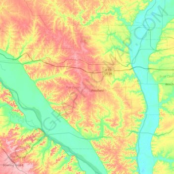
Name: Pike County topographic map, elevation, terrain.
Location: Pike County, Illinois, United States (39.39519 -91.37001 39.84417 -90.56735)
Average elevation: 184 m
Minimum elevation: 127 m
Maximum elevation: 283 m
Other topographic maps
Click on a map to view its topography, its elevation and its terrain.
Bee Creek
United States > Illinois > Pike County > Bee Creek
Bee Creek, Pike County, Illinois, United States
Average elevation: 164 m
Nebo
United States > Illinois > Pike County
Nebo, Pike County, Illinois, 62355, United States
Average elevation: 164 m