Geolocate

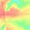
Heliópolis topographic map

Click on the map to display elevation.

About this map

Name: Heliópolis topographic map, elevation, terrain.

Location: Heliópolis, Região Geográfica Imediata de Cícero Dantas, Região Geográfica Intermediária de Paulo Afonso, Bahia, Northeast Region, 48445-000, Brazil (-10.87610 -38.37716 -10.63595 -38.19899)

Average elevation: 279 m

Minimum elevation: 205 m

Maximum elevation: 421 m

Other topographic maps

Click on a map to view its topography, its elevation and its terrain.
Donana

Brazil > Bahia > Andaraí

Average elevation: 423 m

610

Brazil > Bahia > Formosa do Rio Preto

Average elevation: 600 m

Gear up for your next adventure:

🔥Camping Stoves - Portable stoves for outdoor cooking
📷Backpack Camera Clips - Quick access to your camera while keeping your hands free for climbing
🔋Rechargeable Batteries - Eco-friendly power for high-drain GPS units and flashlights
📕Australia Maps - Maps covering Australian regions
🧰Survival Kits - Essential survival gear

As an Amazon Associate, this site earns from qualifying purchases at no extra cost to you.