Geolocate

Spring topographic map

Click on the map to display elevation.

About this map

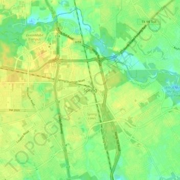
Name: Spring topographic map, elevation, terrain.

Location: Spring, Harris County, Texas, 77373:77388, United States (30.03988 -95.45725 30.11988 -95.37725)

Average elevation: 35 m

Minimum elevation: 23 m

Maximum elevation: 45 m

Gear up for your next adventure:

🕶️Polarized Outdoor Sunglasses - Reduce glare from rocks and water for better visual navigation
🍳Ultralight Camping Stoves - Boil water quickly for meals using minimal fuel
🧼Biodegradable Outdoor Soap - Clean gear and yourself without harming the local ecosystem
🗺️Topographic Maps - Detailed maps for hiking and navigation
GPS Watches - GPS watches for outdoor sports

As an Amazon Associate, this site earns from qualifying purchases at no extra cost to you.