
Thank you for supporting this site ❤️
Make a donation
Make a donation
Gear up for your next adventure:
As an Amazon Associate, this site earns from qualifying purchases at no extra cost to you.
Vleuten topographic map
Click on the map to display elevation.
Thank you for supporting this site ❤️
Make a donation
Make a donation
Gear up for your next adventure:
As an Amazon Associate, this site earns from qualifying purchases at no extra cost to you.
About this map
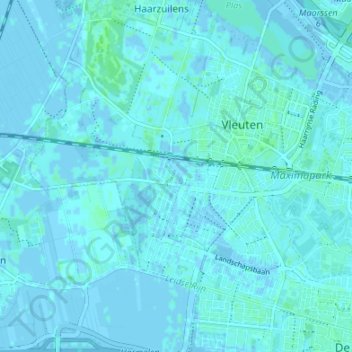
Name: Vleuten topographic map, elevation, terrain.
Location: Vleuten, Vleuten - De Meern, Utrecht, Netherlands (52.08558 4.97291 52.11705 5.04014)
Average elevation: 1 m
Minimum elevation: -5 m
Maximum elevation: 5 m
Thank you for supporting this site ❤️
Make a donation
Make a donation
Gear up for your next adventure:
As an Amazon Associate, this site earns from qualifying purchases at no extra cost to you.