

Pachuca topographic map
Click on the map to display elevation.
Pachuca
Pachuca has a semi-arid climate (Köppen climate classification BSk). The climate is cool with high rainfall and occasional hail during the summer months and dry conditions during the winter. The coldest month is January, with an average high of 20 °C (68 °F) and an average low of 3 °C (37 °F). Winter nights are cold and the temperature can drop below 0 °C (32 °F). The warmest month is May, with an average high of 24 °C (75 °F) and a low of 9 °C (48 °F). Due to its high altitude, nighttime temperatures remain cool throughout the year. The average annual precipitation is 412 millimetres (16.2 in), mostly concentrated in the months May through September. In terms of extremes, the record high was 40 °C (104 °F) and the record low was −9 °C (16 °F).
About this map
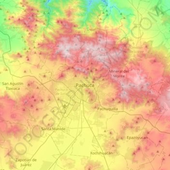
Name: Pachuca topographic map, elevation, terrain.
Location: Pachuca, Pachuca de Soto, Hidalgo, 42040, Mexico (19.95654 -98.90135 20.27654 -98.58135)
Average elevation: 2,459 m
Minimum elevation: 1,794 m
Maximum elevation: 3,105 m