

Aspen topographic map
Click on the map to display elevation.
Aspen
Aspen is a home rule municipality that is the county seat and the most populous municipality of Pitkin County, Colorado, United States. The city population was 7,004 at the 2020 United States Census. Aspen is in a remote area of the Rocky Mountains' Sawatch Range and Elk Mountains, along the Roaring Fork River at an elevation just below 8,000 feet (2,400 m) above sea level on the Western Slope, 11 miles (18 km) west of the Continental Divide. Aspen is now a part of the Glenwood Springs, CO Micropolitan Statistical Area.
About this map
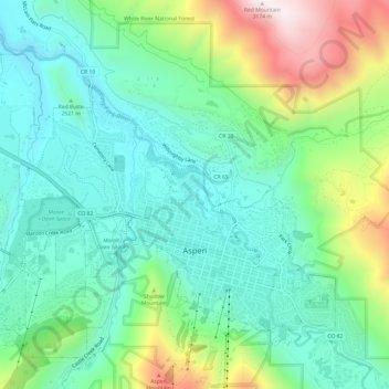
Name: Aspen topographic map, elevation, terrain.
Location: Aspen, Pitkin County, Colorado, United States (39.17706 -106.86215 39.21842 -106.80173)
Average elevation: 2,568 m
Minimum elevation: 2,328 m
Maximum elevation: 3,162 m