

Eureka topographic map
Click on the map to display elevation.
Eureka
The city marina is on one of three islands at a narrow point on the 13-mile-long (21 km) bay and increases in elevation slightly as it spreads north, south, and especially to the east. The city gently encroaches at least two miles (3.2 km) eastward into primarily Redwood and Douglas-fir second growth forests. The city has a traditional grid that generally radiates toward the points of the compass. Most post-1970 houses were built in formerly clear cut forested areas.
About this map
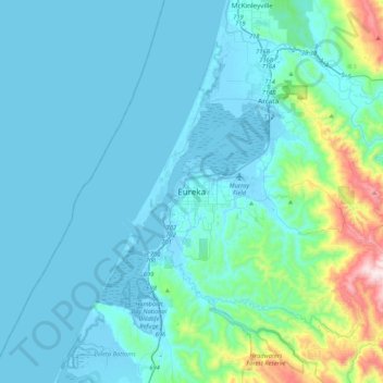
Name: Eureka topographic map, elevation, terrain.
Location: Eureka, Humboldt County, California, 95502, United States (40.63069 -124.32737 40.95069 -124.00737)
Average elevation: 100 m
Minimum elevation: -5 m
Maximum elevation: 854 m