Geolocate

Henfield topographic map

Click on the map to display elevation.

About this map

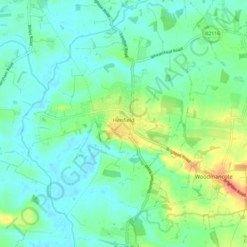
Name: Henfield topographic map, elevation, terrain.

Location: Henfield, Horsham, West Sussex, England, United Kingdom (50.90320 -0.31034 50.95664 -0.24418)

Average elevation: 14 m

Minimum elevation: -2 m

Maximum elevation: 52 m

Gear up for your next adventure:

🛌Sleeping Bags - Sleeping bags for outdoor camping
Outdoor Coffee Makers - Enjoy quality coffee at the summit of your favorite peak
📣High-Decibel Survival Whistles - Signaling tool for rescue that carries much further than a human voice
🍴Titanium Spork & Cutlery - Indestructible and feather-light eating utensils
📡Weather Radios - Emergency weather radios

As an Amazon Associate, this site earns from qualifying purchases at no extra cost to you.