
Thank you for supporting this site ❤️
Make a donation
Make a donation
Gear up for your next adventure:
As an Amazon Associate, this site earns from qualifying purchases at no extra cost to you.
Zmutt topographic map
Click on the map to display elevation.
Thank you for supporting this site ❤️
Make a donation
Make a donation
Gear up for your next adventure:
As an Amazon Associate, this site earns from qualifying purchases at no extra cost to you.
About this map
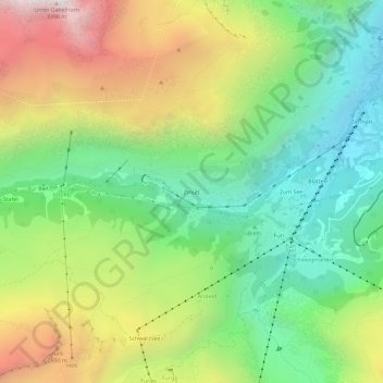
Name: Zmutt topographic map, elevation, terrain.
Location: Zmutt, Zermatt, Visp, Wallis, 3920, Switzerland (45.98648 7.69709 46.02648 7.73709)
Average elevation: 2,292 m
Minimum elevation: 1,615 m
Maximum elevation: 3,347 m
Thank you for supporting this site ❤️
Make a donation
Make a donation
Gear up for your next adventure:
As an Amazon Associate, this site earns from qualifying purchases at no extra cost to you.