Geolocate

Exeter topographic map

Click on the map to display elevation.

About this map

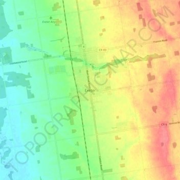
Name: Exeter topographic map, elevation, terrain.

Location: Exeter, South Huron, Huron County, Ontario, N0M 1S1, Canada (43.30499 -81.52011 43.38499 -81.44011)

Average elevation: 268 m

Minimum elevation: 240 m

Maximum elevation: 301 m

Gear up for your next adventure:

🛰️Handheld GPS Units - Rugged GPS devices for tracking coordinates and elevation in the Australian bush
🧣Merino Neck Gaiters - Versatile headwear for warmth, sun protection, or dust filtering
Altimeter Watches - Watches with altitude tracking
🕯️Emergency Whistles - Safety whistles for hiking
📚Map Reading & Navigation Guides - Master the art of interpreting topographic contours and symbols

As an Amazon Associate, this site earns from qualifying purchases at no extra cost to you.