
Make a donation
Gear up for your next adventure:
As an Amazon Associate, this site earns from qualifying purchases at no extra cost to you.
Kolar topographic map
Click on the map to display elevation.
Make a donation
Gear up for your next adventure:
As an Amazon Associate, this site earns from qualifying purchases at no extra cost to you.
Kolar
Kolar is located at 13°08′N 78°08′E / 13.13°N 78.13°E / 13.13; 78.13. with an average elevation of 849 metres (2,785 ft).
Make a donation
Gear up for your next adventure:
As an Amazon Associate, this site earns from qualifying purchases at no extra cost to you.
About this map
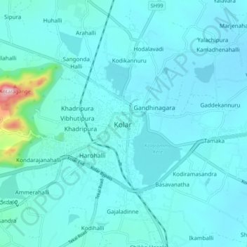
Name: Kolar topographic map, elevation, terrain.
Location: Kolar, Kolar taluk, Kolar district, Karnataka, 563101, India (12.97672 77.97372 13.29672 78.29372)
Average elevation: 847 m
Minimum elevation: 780 m
Maximum elevation: 1,221 m
Make a donation
Gear up for your next adventure:
As an Amazon Associate, this site earns from qualifying purchases at no extra cost to you.