Geolocate

Somerton topographic map

Click on the map to display elevation.

About this map

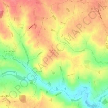
Name: Somerton topographic map, elevation, terrain.

Location: Somerton, Babergh, Suffolk, England, United Kingdom (52.12900 0.63334 52.16150 0.66219)

Average elevation: 83 m

Minimum elevation: 42 m

Maximum elevation: 113 m

Other topographic maps

Click on a map to view its topography, its elevation and its terrain.

Sudbury

United Kingdom > England > Suffolk > Babergh

Average elevation: 54 m

Gear up for your next adventure:

🎒40L Day Hiking Backpacks - Comfortable packs with hydration support for long days exploring topographic peaks
🔥Camping Stoves - Portable stoves for outdoor cooking
📡Weather Radios - Emergency weather radios
🧤Hiking Gloves - Protective gloves for outdoor use
📖Australian Bush Survival Books - Local knowledge on finding water and surviving the outback

As an Amazon Associate, this site earns from qualifying purchases at no extra cost to you.