Geolocate

Barcelos topographic map

Click on the map to display elevation.

About this map
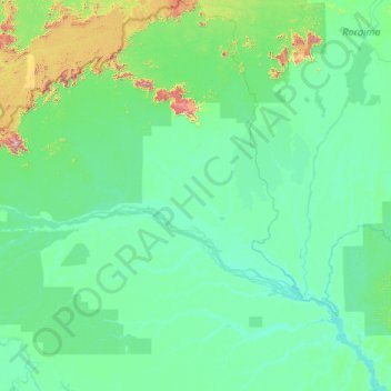
Name: Barcelos topographic map, elevation, terrain.

Location: Barcelos, Região Geográfica Imediata de São Gabriel da Cachoeira, Região Geográfica Intermediária de Manaus, Amazonas, North Region, Brazil (-2.49400 -65.37900 2.21182 -61.38200)

Average elevation: 111 m

Minimum elevation: 10 m

Maximum elevation: 2,265 m

Other topographic maps

Click on a map to view its topography, its elevation and its terrain.

Serra do Aracá

Brazil > Amazonas > Barcelos

Average elevation: 509 m

Gear up for your next adventure:

📻Handheld UHF Radios - Critical communication for groups in the Australian outback
🎒Dry Bags - Waterproof bags for outdoor gear
👄SPF Lip Balm - Prevent sun and wind-burnt lips on mountain ridges
🧥Packable Rain Jackets - Breathable waterproof layers for unpredictable mountain weather
🚴Bike GPS - GPS devices for cycling

As an Amazon Associate, this site earns from qualifying purchases at no extra cost to you.