Geolocate

Eton topographic map

Click on the map to display elevation.

About this map

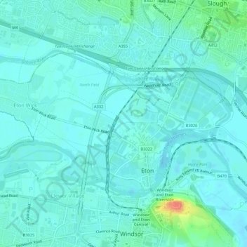
Name: Eton topographic map, elevation, terrain.

Location: Eton, Royal Borough of Windsor and Maidenhead, England, United Kingdom (51.48532 -0.64451 51.50443 -0.59106)

Average elevation: 23 m

Minimum elevation: 15 m

Maximum elevation: 64 m

Other topographic maps

Click on a map to view its topography, its elevation and its terrain.

Gear up for your next adventure:

📚Map Reading & Navigation Guides - Master the art of interpreting topographic contours and symbols
🆘Personal Locator Beacons (PLB) - Satellite emergency beacons for life-saving help in areas with no mobile coverage
🛠️Outdoor Repair Kits - Gear repair kits
📡Satellite Messengers - Emergency communication devices
🔌Fast Charging Adapters - Quickly top up all your gear before heading back into the field

As an Amazon Associate, this site earns from qualifying purchases at no extra cost to you.