Geolocate

America topographic map

Click on the map to display elevation.

About this map
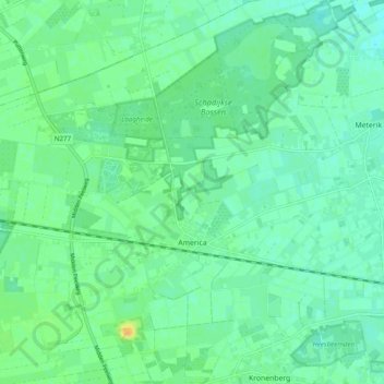
Name: America topographic map, elevation, terrain.

Location: America, Horst aan de Maas, Limburg, Netherlands (51.41890 5.91638 51.47140 6.01373)

Average elevation: 31 m

Minimum elevation: 22 m

Maximum elevation: 50 m

Other topographic maps

Click on a map to view its topography, its elevation and its terrain.
Eiland van Bèr

Netherlands > Limburg > Maastricht

Average elevation: 137 m

Gear up for your next adventure:

🚁Camera Drones with GPS - Capture aerial views of the landscape to compare with topo maps
⌚GPS Watches - GPS watches for outdoor sports
📕Australia Maps - Maps covering Australian regions
🧼Biodegradable Outdoor Soap - Clean gear and yourself without harming the local ecosystem
🏃Compression Recovery Socks - Reduce leg fatigue after heavy days of elevation gain

As an Amazon Associate, this site earns from qualifying purchases at no extra cost to you.