
Make a donation
Gear up for your next adventure:
As an Amazon Associate, this site earns from qualifying purchases at no extra cost to you.
Ipatinga topographic map
Click on the map to display elevation.
Make a donation
Gear up for your next adventure:
As an Amazon Associate, this site earns from qualifying purchases at no extra cost to you.
Ipatinga
In 1956, a Japanese commission visited the then-district of Ipatinga, selecting it as the site for the Usiminas steel plant. Factors influencing this decision included suitable topography, proximity to raw material sources and consumer markets, availability of water resources, abundant electricity, local railway infrastructure, and proximity to other steelmaking centers. News of the steel plant's construction attracted many new residents even before its establishment, necessitating urban planning for the city.
Make a donation
Gear up for your next adventure:
As an Amazon Associate, this site earns from qualifying purchases at no extra cost to you.
About this map
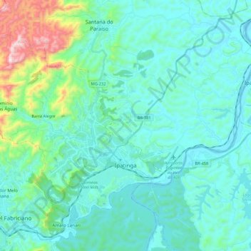
Name: Ipatinga topographic map, elevation, terrain.
Average elevation: 329 m
Minimum elevation: 200 m
Maximum elevation: 1,035 m
Make a donation
Gear up for your next adventure:
As an Amazon Associate, this site earns from qualifying purchases at no extra cost to you.