

Crestview topographic map
Click on the map to display elevation.
Crestview
Crestview is a city in Okaloosa County, Florida, United States. The population was 27,134 at the 2020 census, up from 20,978 at the 2010 census. It is the county seat of Okaloosa County. With an elevation of 235 feet (72 m) above sea level, it is one of the highest points in the state; it receives 65 inches (1,700 mm) of rainfall annually, the second-most of any city in the state of Florida, after Fort Walton Beach with 69 inches.
About this map
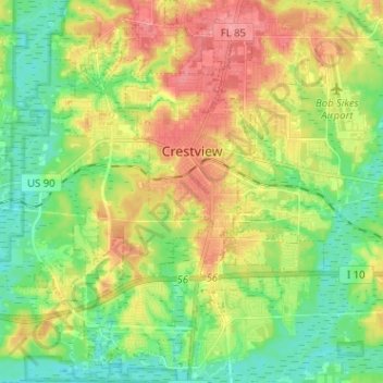
Name: Crestview topographic map, elevation, terrain.
Location: Crestview, Okaloosa County, Florida, United States (30.69569 -86.63562 30.80514 -86.52671)
Average elevation: 43 m
Minimum elevation: 10 m
Maximum elevation: 89 m