

Pune topographic map
Click on the map to display elevation.
Pune
Pune is situated at approximately 18° 32" north latitude and 73° 51" east longitude. The area of Pune district is 15,642 km2, and the municipal corporation area covers 518 km2. By road Pune is 149 km (93 mi) south-east of Mumbai, 580 km (360 mi) south-west of Indore, 695 km (432 mi) west of Nagpur, 1,173 km (729 mi) south of Delhi, 734 km (456 mi) north of Bangalore, 562 km (349 mi) north-west of Hyderabad. Pune lies on the western margin of the Deccan Plateau, at an altitude of 560 m (1,840 ft) above sea level. It is on the leeward side of the Sahyadri mountain range, which forms a barrier from the Arabian Sea. It is a hilly city, with Vetal Hill rising to 800 m (2,600 ft) above sea level. The Sinhagad fort is at an altitude of 1,300 metres (4,300 feet).
About this map
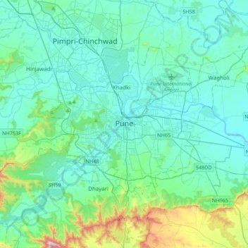
Name: Pune topographic map, elevation, terrain.
Average elevation: 641 m
Minimum elevation: 526 m
Maximum elevation: 1,304 m
Other topographic maps
Click on a map to view its topography, its elevation and its terrain.


Magarpatta City School Ground
India > Maharashtra > Pune City Subdistrict > Pune
Average elevation: 568 m