Geolocate

Pinehurst topographic map

Click on the map to display elevation.

About this map
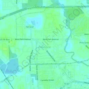
Name: Pinehurst topographic map, elevation, terrain.

Location: Pinehurst, Orange County, Texas, United States (30.09367 -93.78644 30.12250 -93.74962)

Average elevation: 5 m

Minimum elevation: 1 m

Maximum elevation: 9 m

Gear up for your next adventure:

🆘Personal Locator Beacons (PLB) - Satellite emergency beacons for life-saving help in areas with no mobile coverage
📣High-Decibel Survival Whistles - Signaling tool for rescue that carries much further than a human voice
🦯Adjustable Trekking Poles - Reduce impact on knees when descending steep topographic ridges
🧯Animal Deterrent Spray - Safety spray for wildlife
📱Shockproof Phone Cases - Extra protection for your smartphone against drops on rocky terrain

As an Amazon Associate, this site earns from qualifying purchases at no extra cost to you.