
Chula Vista topographic map
Click on the map to display elevation.
About this map
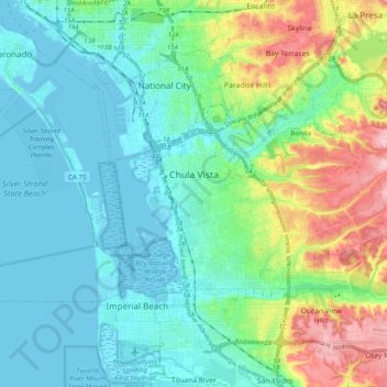
Name: Chula Vista topographic map, elevation, terrain.
Location: Chula Vista, San Diego County, California, United States (32.57797 -117.12401 32.68562 -116.92773)
Average elevation: 42 m
Minimum elevation: -3 m
Maximum elevation: 174 m
Other topographic maps
Click on a map to view its topography, its elevation and its terrain.