
City of Niagara Falls topographic map
Interactive map
Click on the map to display elevation.
About this map
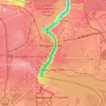
Name: City of Niagara Falls topographic map, elevation, terrain.
Average elevation: 180 m
Minimum elevation: 75 m
Maximum elevation: 220 m
Other topographic maps
Click on a map to view its topography, its elevation and its terrain.
Black Creek Village
United States > New York > Niagara County > City of Niagara Falls
Black Creek Village, City of Niagara Falls, Niagara County, New York, 14304, United States
Average elevation: 176 m
Village of Barker
United States > New York > Niagara County
Village of Barker, Town of Somerset, Niagara County, New York, United States
Average elevation: 102 m