Geolocate

Hermiston topographic map

Click on the map to display elevation.

About this map

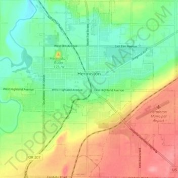
Name: Hermiston topographic map, elevation, terrain.

Location: Hermiston, Umatilla County, Oregon, 97838, United States (45.80593 -119.32672 45.86478 -119.24867)

Average elevation: 160 m

Minimum elevation: 124 m

Maximum elevation: 208 m

Gear up for your next adventure:

Altimeter Barometer Watches - Outdoor watches with built-in sensors to track altitude changes and weather shifts
📟Satellite Messengers - Two-way satellite communication to stay in touch beyond the cellular grid
🦘Outback Survival Gear - Essential gear for Australian outback
📕Hiking Guide Books - Guides for hiking trails
📷Backpack Camera Clips - Quick access to your camera while keeping your hands free for climbing

As an Amazon Associate, this site earns from qualifying purchases at no extra cost to you.