Geolocate

Penshurst topographic map

Click on the map to display elevation.

About this map
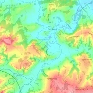
Name: Penshurst topographic map, elevation, terrain.

Location: Penshurst, Sevenoaks, Kent, England, United Kingdom (51.13180 0.15014 51.19077 0.21539)

Average elevation: 66 m

Minimum elevation: 24 m

Maximum elevation: 135 m

Gear up for your next adventure:

🕯️Emergency Whistles - Safety whistles for hiking
🔪Outdoor Multi-tools - Versatile tools for gear repair and survival tasks in the wilderness
🪢550 Survival Paracord - Versatile cordage for gear repair and emergency lashing
🦯Trekking Poles - Walking poles for hiking stability
🧼Biodegradable Outdoor Soap - Clean gear and yourself without harming the local ecosystem

As an Amazon Associate, this site earns from qualifying purchases at no extra cost to you.