
Thank you for supporting this site ❤️
Make a donation
Make a donation
Gear up for your next adventure:
As an Amazon Associate, this site earns from qualifying purchases at no extra cost to you.
Mġarr topographic map
Click on the map to display elevation.
Thank you for supporting this site ❤️
Make a donation
Make a donation
Gear up for your next adventure:
As an Amazon Associate, this site earns from qualifying purchases at no extra cost to you.
About this map
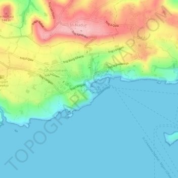
Name: Mġarr topographic map, elevation, terrain.
Location: Mġarr, Għajnsielem, Gozo Region, 1022, Malta (36.00454 14.27640 36.04454 14.31640)
Average elevation: 50 m
Minimum elevation: -1 m
Maximum elevation: 161 m
Thank you for supporting this site ❤️
Make a donation
Make a donation
Gear up for your next adventure:
As an Amazon Associate, this site earns from qualifying purchases at no extra cost to you.