Geolocate

Prinza topographic map

Click on the map to display elevation.

About this map

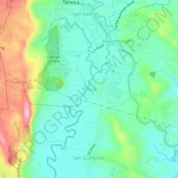
Name: Prinza topographic map, elevation, terrain.

Location: Prinza, Teresa, Rizal, Calabarzon, 1960, Philippines (14.51933 121.19221 14.55933 121.23221)

Average elevation: 86 m

Minimum elevation: 12 m

Maximum elevation: 260 m

Gear up for your next adventure:

📸Action Cameras - Record your journey across interesting topographic features in 4K
Ultralight Solo Tents - Compact shelters for multi-day topographic surveying expeditions
🔪Outdoor Multi-tools - Versatile tools for gear repair and survival tasks in the wilderness
🧺Fast-Dry Microfiber Towels - Large towels that pack down to the size of an orange
🔪Multitools - Compact tools for outdoor use

As an Amazon Associate, this site earns from qualifying purchases at no extra cost to you.