Geolocate

Amos topographic map

Click on the map to display elevation.

About this map
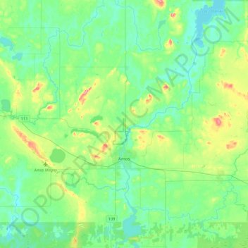
Name: Amos topographic map, elevation, terrain.

Location: Amos, Abitibi, Abitibi-Témiscamingue, Quebec, Canada (48.50221 -78.22408 48.71955 -77.79997)

Average elevation: 313 m

Minimum elevation: 287 m

Maximum elevation: 396 m

Gear up for your next adventure:

🦶Orthotic Hiking Insoles - Extra arch support for long-distance topographic treks
🎽Hiking Clothing - Breathable clothing for hiking
💧Personal Water Filters - Drink safely from streams and lakes identified on your map
👖Convertible Hiking Trousers - Zip-off legs to adapt to changing temperatures throughout the day
⛺Lightweight Tents - Compact tents for backpacking

As an Amazon Associate, this site earns from qualifying purchases at no extra cost to you.