Geolocate

Venlo topographic map

Click on the map to display elevation.

About this map

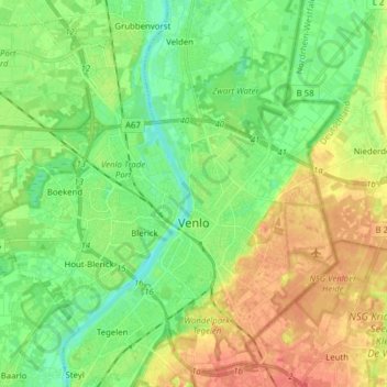
Name: Venlo topographic map, elevation, terrain.

Location: Venlo, Limburg, Netherlands (51.33357 6.07178 51.42132 6.22677)

Average elevation: 27 m

Minimum elevation: 9 m

Maximum elevation: 53 m

Other topographic maps

Click on a map to view its topography, its elevation and its terrain.

Hout-Blerick

Netherlands > Limburg > Venlo

Average elevation: 22 m

Gear up for your next adventure:

🔑Heavy Duty Carabiners - Secure gear to the outside of your pack for easy access
🧥Softshell Jackets - Flexible outdoor jackets
🎨Portable Watercolor Kits - Paint the landscapes and topographic views you discover
🚗Car Camping Gear - Equipment for vehicle camping
🪢Paracord - Multi-purpose survival cord

As an Amazon Associate, this site earns from qualifying purchases at no extra cost to you.