
Lake Superior topographic map
Interactive map
Click on the map to display elevation.
About this map
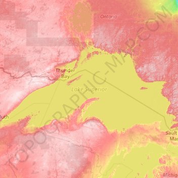
Name: Lake Superior topographic map, elevation, terrain.
Average elevation: 318 m
Minimum elevation: 101 m
Maximum elevation: 665 m
Lake Superior, the largest of the Great Lakes of North America, is also the world's largest freshwater lake by surface area, and the third largest freshwater lake by volume. It is shared by the Canadian province of Ontario to the north, the U.S. state of Minnesota to the west, and Wisconsin and the Upper Peninsula of Michigan to the south. The farthest north and west of the Great Lakes chain, Superior has the highest elevation of all five great lakes and drains into the St. Mary's River.