
Hudson Glacier topographic map
Interactive map
Click on the map to display elevation.
About this map
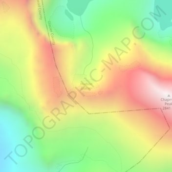
Name: Hudson Glacier topographic map, elevation, terrain.
Average elevation: 2,079 m
Minimum elevation: 1,411 m
Maximum elevation: 2,853 m
Other topographic maps
Click on a map to view its topography, its elevation and its terrain.
Harris Glacier
USA > Montana > Wurtz Hill
Harris Glacier, Boulder Pass, Wurtz Hill, Flathead County, Montana, USA
Average elevation: 2,138 m
Thunderbird Glacier
USA > Montana > Wurtz Hill
Thunderbird Glacier, Boulder Pass, Wurtz Hill, Flathead County, Montana, USA
Average elevation: 2,162 m
Boulder Glacier
USA > Montana > Wurtz Hill
Boulder Glacier, Boulder Pass, Wurtz Hill, Flathead County, Montana, USA
Average elevation: 2,105 m
Agassiz Glacier
USA > Montana > Wurtz Hill
Agassiz Glacier, Boulder Pass, Wurtz Hill, Flathead County, Montana, USA
Average elevation: 2,376 m